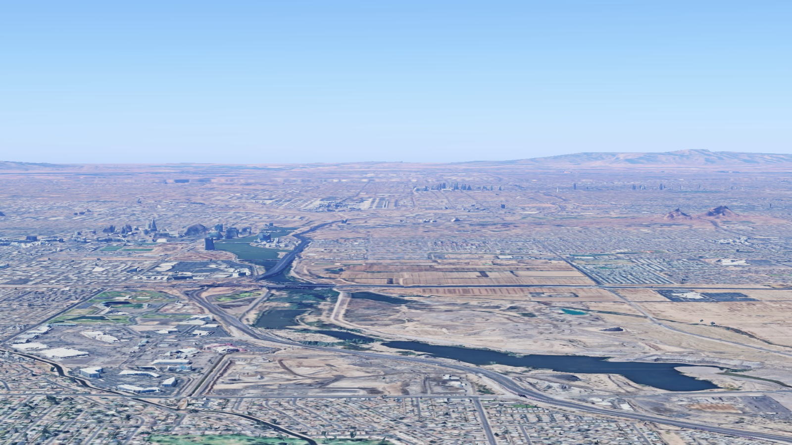
In the heart of the Arizona desert, water has always been both a lifeline and a rarity. Today, as Phoenix and its sister cities stretch ever wider, a bold idea is gaining traction: to “reimagine” the river, not as a piped drainage channel, but as a ribbon of ecological, social, and economic opportunity threading through the Valley. Rio Reimagined is that vision — a multi-decadal, regional initiative to restore, reconnect, and revitalize the 45–60-mile stretch of the Salt and Gila rivers (also known as the Rio Salado corridor) across multiple municipalities, tribal lands, and jurisdictions.
Why now? Several converging pressures have made this moment ripe: escalating heat, extreme weather events, rising awareness of environmental justice, and a growing appetite for place-making in the desert metropolis. Phoenix’s draft general plans, infill priorities, and resiliency strategies all hint that livability, green infrastructure, and water-smart development will be central in the coming decades. Within the Valley, neighborhoods like South Phoenix, the Salt River communities, and infill corridors adjacent to the river stand to be transformed. Major development nodes such as along Central Avenue, near 7th Street, and through Tempe’s riverfront already carry latent potential.
But Rio Reimagined isn’t just an aesthetic or recreational project — it aspires to weave ecological restoration, community equity, flood resilience, multimodal mobility, and economic renewal into one integrated corridor. In doing so, it offers a compelling case study in how a southwestern city can rewild a riverized corridor and reanchor urban growth in nature.
The river corridor today is paradoxical. The historic Salt and Gila rivers once flowed periodically, fed by snowmelt and native ecosystems. Over time, diversions, concrete channels, ephemeral flows, and fragmented infrastructure have disconnected the Valley from its river heritage. What remains is often an underutilized strip: concrete banks, limited ecology, poor connectivity, heat islands, and disjointed land use. Many communities along the river suffer from lack of access, exposure to heat, and limited investment.
Imagine, though, lining that same corridor with continuous trails, native riparian habitat, stormwater capture zones, shade, art, economic nodes, housing, and transit connection. The friction lies in alignment: jurisdictions, funding, land ownership, shifting hydrology, flood risk, and community expectations. Without coordination, piecemeal projects may not cohere.
For decades, pockets of revitalization in Tempe, near Tempe Town Lake, or small river parks have shown glimpses of what a river corridor could do — increased property values, foot traffic, tourism, nature engagement. But those successes are isolated. On the rest of the corridor, the river is invisible: disconnected from neighborhoods, overshadowed by infrastructure, and often forgotten.
Residents may feel excluded or skeptical: Will this benefit them, or just new development? Will the risks — flooding, maintenance, displacement — outweigh the promise? Without a compelling, credible plan, skepticism wins. And in fast-growing Phoenix, the urgency is real: climate stress, water scarcity, hunger for identity, and pressure on infrastructure demand a long view.
Here’s where Rio Reimagined delivers its knock: a multi-scale framework that aligns ecological health, mobility, placemaking, and equity. It envisions restoring ecosystem functions in the watershed, mitigating flood and heat, delivering continuous active-transportation infrastructure (bike/ped trails), and unlocking development nodes along the river banks.
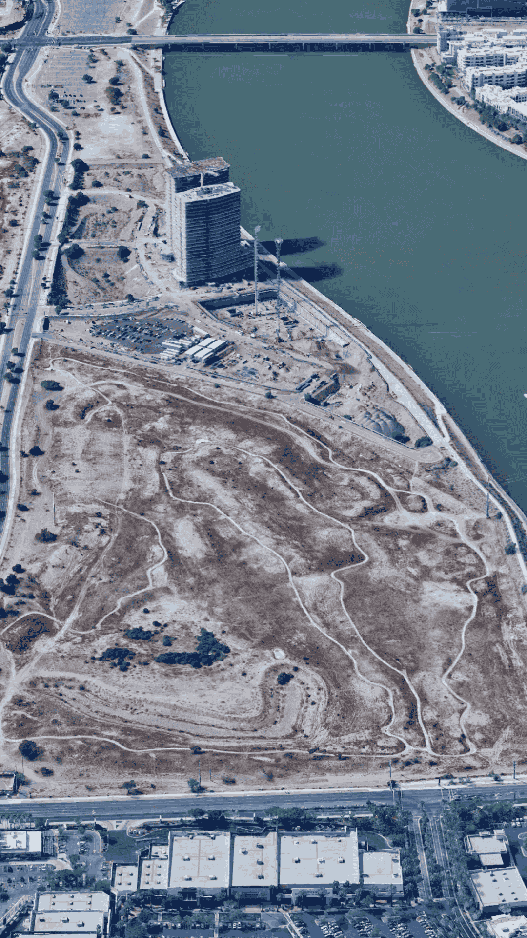
For example, Phoenix recently acquired a 30-acre industrial site near 7th Street & the Salt River for ~$29.5 million, slated to become part of the corridor’s transformation. The Phoenix segment (dubbed RIO PHX) spans ~20 miles and is projected as a 25–40 year buildout, with most major phases within the first 25 years.
The call to action is clear: stakeholders can’t afford to defer. The river is a rare connective asset in a sprawling metropolis. If orchestrated wisely, Rio Reimagined could anchor Phoenix’s next chapter — a river-centric system for climate resilience, public health, real estate activation, and social inclusion.

Not all river revitalizations follow a single template. Rio Reimagined must engage multiple typologies tailored to context, hydrology, and community. Below are key typologies and tradeoffs, especially in a desert-river setting, and how they relate to homeownership and equity.
These segments emphasize habitat restoration: soft banks, native riparian plantings, floodable terraces, sediment management, ecological “daylighting.” In low-density zones or where hydrology allows, the natural channel can be reintroduced in portions. This typology maximizes biodiversity and climate adaptation but constrains intensive development and requires more maintenance.
Pros: stronger ecosystem function, wildlife, cooling effects, stormwater absorption
Cons: lower building densities, potential land buyouts, more risk if design is weak
For homeowners near these zones, property buffers and green transitions can improve local climate, reduce flood risk, and boost desirability—but only if designs are robust and well maintained.
In more urban stretches (e.g. close to the core), a continuous riverwalk or promenade with trails, plazas, art, cafes, overlooks can knit together neighborhoods. Think of a “river spine” that connects nodes. Design can allow for adjacent mixed-use development up to the edge, with setbacks, floodable edges, and flood mitigation infrastructure.
Pros: amenity value, placemaking, higher foot traffic, catalytic for real estate
Cons: needs flood engineering, maintenance, clear programming
For homebuyers, adjacency to a well-activated riverwalk often means premium value—but property taxes, risk, and equity concerns must be managed.
Where the river pass-through is constrained (e.g. due to infrastructure, right-of-way constraints), the strategy uses “green fingers” — branching trails, micro-parks, bioswales, pocket habitats connecting neighborhoods toward the river core. These connector networks extend access but don’t require full redevelopment of every corridor.
Pros: lower cost, scalable, incremental
Cons: may feel fragmented unless well stitched
In housing strategy, these connectors raise livability without heavy disruption or displacement.
At major intersections or nodes (bridges, historic districts, transit hubs), the design allows denser mixed-use infill — compact housing, retail, cultural spaces, startup labs, co-working, public plazas — all tied into the riverfront. These nodes act as anchors that animate the corridor and support economic viability.
Pros: densification, tax base growth, job clustering
Cons: risk of gentrification, infrastructure burden
From an equity lens, protecting existing homeowners or tenants by layering affordable housing, inclusionary zoning, land trusts, or community-led development is critical.
A revitalization project like Rio Reimagined must avoid displacement and exclusion. If all value accrues to external developers, the communities nearest the river may be squeezed. Strategic tools (land banking, community choice development, property tax stabilization, participatory planning) must be embedded. Homeownership strategy in the corridor should incentivize existing residents to benefit, not be priced out.
In sum, Rio Reimagined is not a single typology but a mosaic: ecological stretches, activated promenades, connectors, and node densification — all sensitive to hydrology, infrastructure, and social justice.
The success of Rio Reimagined hinges not just on vision, but on local institutions, champions, and coalitions. Here are key actors, their perspectives, and how the local ecosystem is aligning.
Eight river-adjacent entities (cities like Phoenix, Tempe, Mesa, Avondale, Buckeye; Maricopa County; Salt River Pima-Maricopa Indian Community; and Gila River Indian Community) have signed a Statement of Intent to collaborate on Rio Reimagined. Through that structure, stakeholders coordinate design guidelines, land use alignment, funding strategies, and phasing.
The City of Phoenix, under the banner RIO PHX, is driving its 20-mile segment with goals to transform the Rio Salado corridor into a defining feature of culture and nature in the city. City planners envision that all development proposals within the corridor should align with the Rio Reimagined vision. Phoenix’s acquisition of industrial parcels (e.g. the 30-acre site near 7th Street) illustrates municipal commitment to land control as a lever.
Tribal partners, including SRPMIC and Gila River, bring cultural stewardship, water rights experience, and habitat restoration leadership. Their involvement ensures that Indigenous presence and values inform how the river is reimagined. The U.S. Environmental Protection Agency designated Rio Reimagined the 20th site in the Urban Waters Federal Partnership, amplifying federal coordination around urban rivers and equity in water systems.
Local environmental nonprofits (e.g. RiversEdge West) and design firms have already been engaged to frame conceptual strategies, public outreach, visual guides, and ecological baseline studies. Planners emphasize that Rio Reimagined should act as a catalyst — not a rigid blueprint — allowing iterative adaptation.
In recent public outreach, RIO PHX open houses in South Phoenix brought in residents to voice hopes, fears, and priorities. One participant noted:
“I really do believe that we’re really manifesting success here.”
Local journalism (e.g. AZCentral) has chronicled the dual narrative: ecological aspiration, but also the politics of land control, infrastructure, and community inclusion.
Urban designers from ASU and design studios are modeling adaptive flood terraces, bioswales, and shade-shifting corridors to show how the corridor could blend desert ecology with human comfort. These local pilot studies help reduce risk and help citizens visualize the future.
Together, the coalition mosaic — municipal governments, tribal partners, NGOs, community stakeholders, design/academic institutions — anchors Rio Reimagined as a deeply local, but regionally ambitious, effort.
Designing and executing a decades-scale river revitalization demands agile, pragmatic steps. Below are actionable recommendations (with concrete examples) that can guide the Rio Reimagined rollout.
Over time, these practices scaffold trust, reduce risk, and ensure that redevelopment benefits accrue inclusively across the corridor.
Rio Reimagined stands at the threshold of possibility: a once-forgotten river corridor could be reborn as a backbone of ecology, identity, mobility, and equity across the Valley. But the journey is long — likely 25 to 40 years in full — and fraught with tensions: jurisdictional boundaries, funding uncertainties, community inclusion, hydrologic change, and infrastructure strain.
This is not a light retrofit; it is a generational investment. Yet when done right, it can reshape patterns of growth, quality of life, and resilience for Phoenix, Tempe, Mesa, Avondale, Buckeye, and the tribal communities. The vision demands humility — adaptive management, listening to neighbors, and willingness to course-correct — but also audacity: to reclaim a river in the desert not just as water infrastructure, but as an anchor for smart, inclusive urban rebirth.
This article offers frameworks, observations, and strategic ideas from public sources and best practices; it is not a substitute for licensed landscape architects, planners, hydrologists, or local policy experts. Any corridor proposals should be vetted by engineers, tribal partners, floodplain specialists, and affected communities.
 Arizona Cardinals’ $136 Million “Headquarters Alley” Project: How a 217-Acre Deal Will Redefine North Phoenix by 2028
 Exploring Arizona’s Unique Land Ownership Laws: What Every Future Homeowner, Investor, And Relocating Professional Needs To Know

 Public Safety as an Asset Class: The New Scottsdale AdvantageIn today’s Smart City economy, safety isn’t simply about peace of mind—it’s becoming a measurable, marketable asset class. Scottsdale is proving that public safety can be engineered into the fabric of
Nice to meet you! I’m Katrina Golikova, and I believe you landed here for a reason.
I help my clients to reach their real estate goals through thriving creative solutions and love to share my knowledge.